Nicoya to Prados del Sol
Please see why you should come and visit Costa Rica
Created: prior to 2018
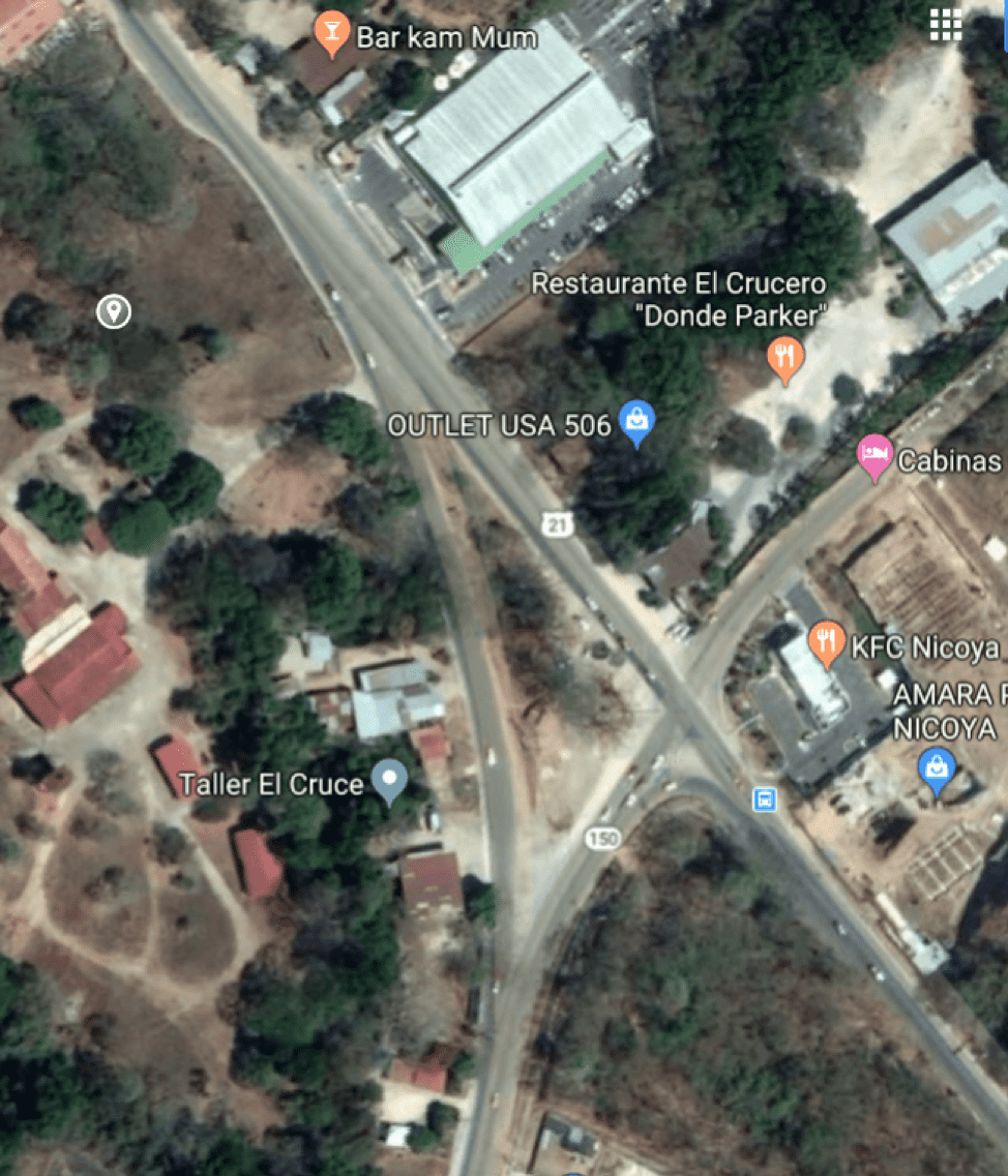
The following map is a detail of the turn TOWARDS Nicoya.
If you are coming from Santa Cruz (Liberia side) you will take the angled turn to the South (Right, what some would call a very long 'off ramp'), which is just before the KFC. If you miss that 'easy' turn, you have another chance at the crossroads - which is immediately before the KFC.
If you are coming from the Tres Hermanos (San Jose) side, you will turn South (left, on what some would call a very small off ramp) onto Highway 150 when the KFC is on your right
The above image is a tiny portion of the next image. The image above is between the 'To Liberia' and 'To San Jose' labels. The 4 way intersection of the roads marked in yellow below.
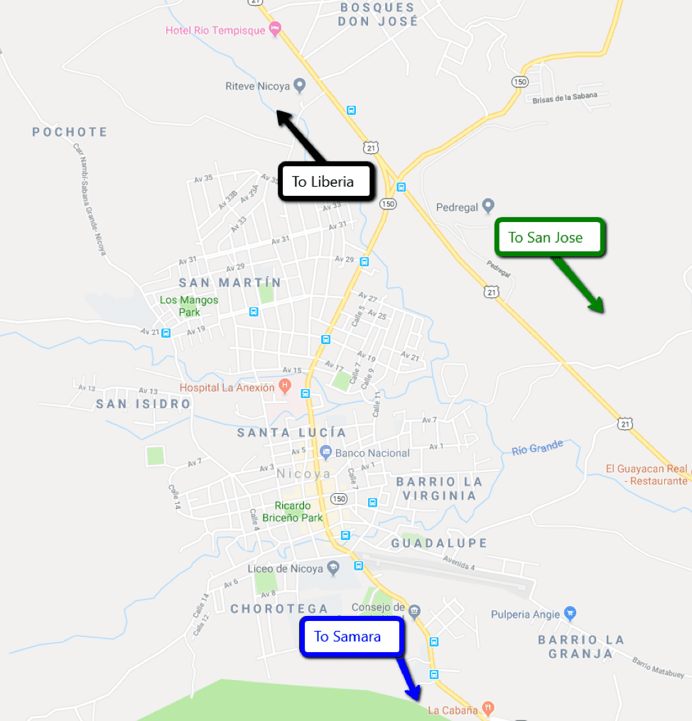
Nicoya is a good place to fill up on gas so you have lots wherever your travels lead you. This is a portion of the above map of Nicoya.
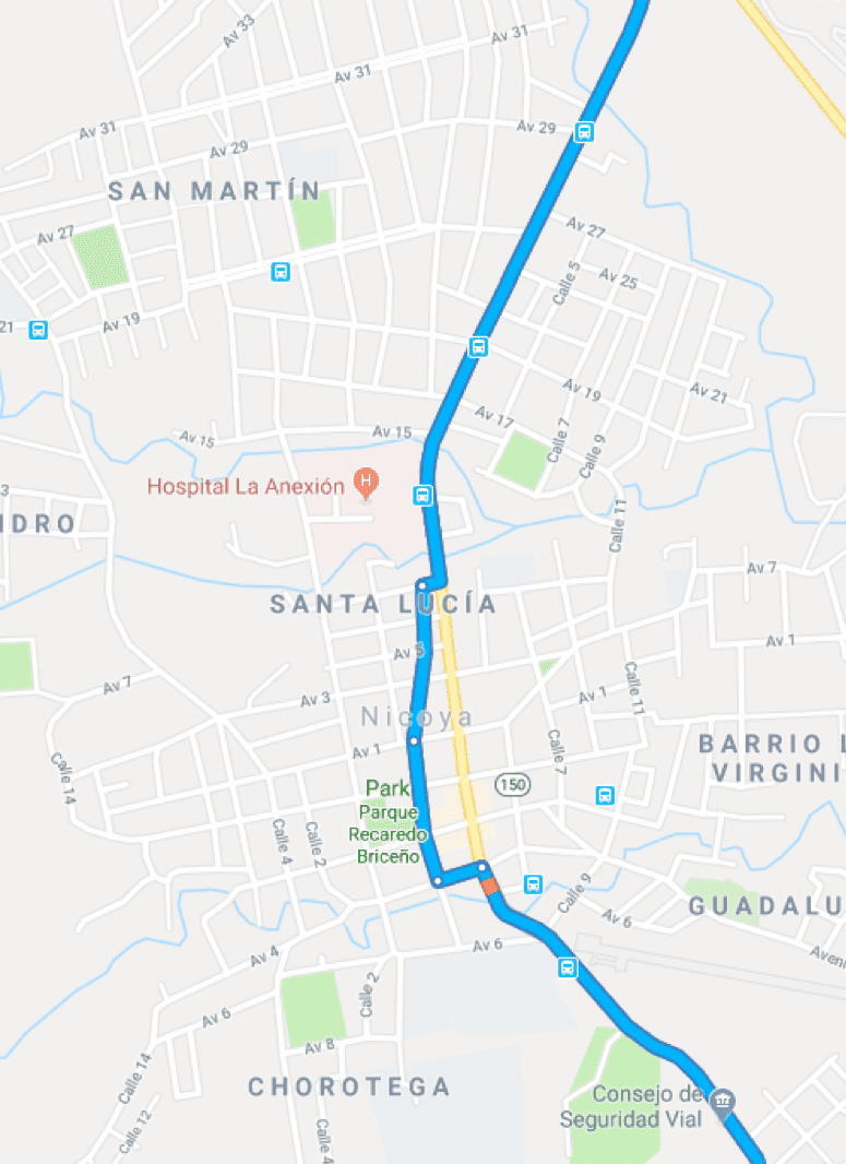
Note that you will make a jog 1 block West, because there is a section of the road is one way North. If you come back this way you won't make the 1 block jog, because you'll be heading North on the 1 way section.
Shortly after Nicoya, you will come to a T intersection, you will turn Right at it. But again, for you trip back, take a quick look to the Left - you will see that the road you are on and the road to the right are the same quality, but the road to the left is clearly a lower traffic road.
Continue towards Sámara and Nosara. Keep your eyes out for a Gas Station, a Grocery store and a Hardware store on the left side of the street. Slow way down when you see the Gas station.
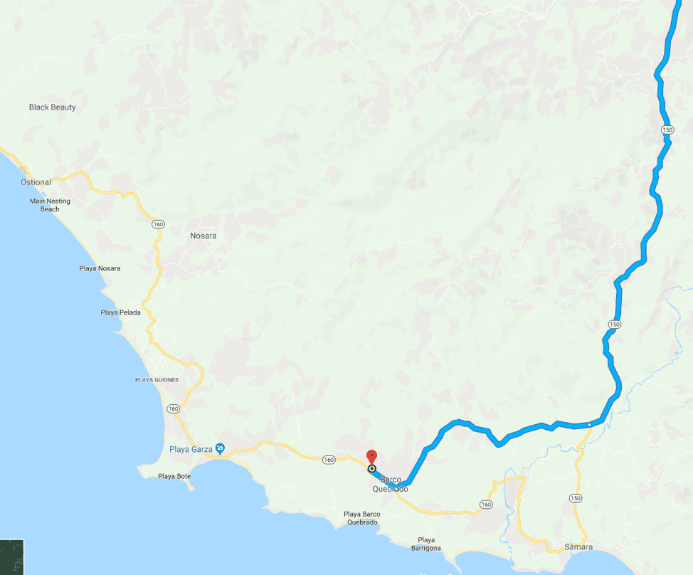
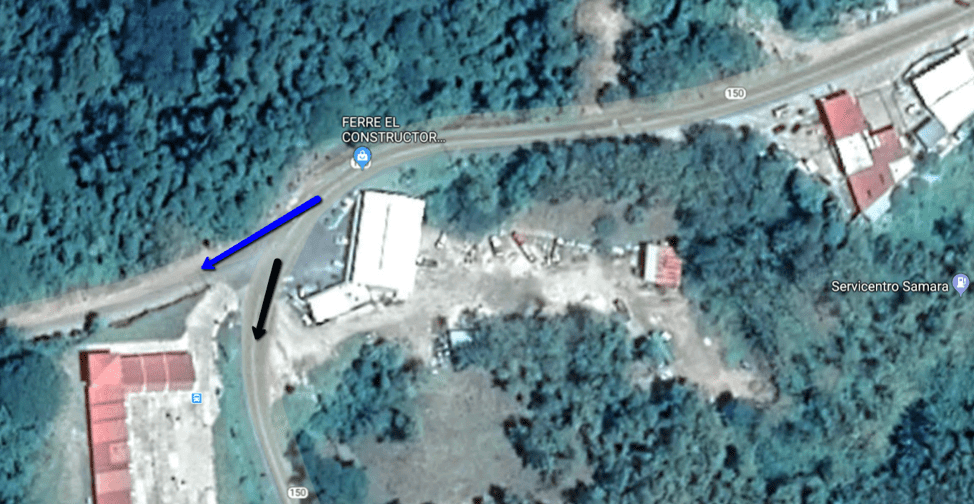
When you see the Gas/Service station on your left - your turn is about 100 meters (about 1 average city block) further on the right. Ferre El Construction.
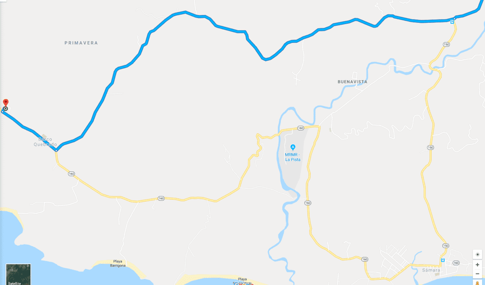
Now that you are on the road heading more or less West, you will find it a mix of pavement and gravel/dirt road. The Costa Rica government built bridges for the river crossings around 2015, and in 2019 they started to pave bits and pieces of this road. As of Summer 2019, it feels like about 1/3 of the road is paved, the gravel parts can be rough, but if you don't drive too fast, it is always navigable even in a small car. About 2 minutes before you get to the Prados del Sol units, you will come to a T intersection.
The road to the left takes you to the 2 closest beaches, including the famous, but poorly marked, Barrigona beach.
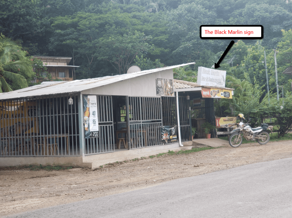
At the T intersection, you will see the 'Black Marlin' restaurant a half block to the right. That is the direction you want to go - the right, NW. Continue about 2 minutes and the Prados del Sol units will be on your right. Welcome!
The rest of the maps and images are 'more detailed' looks at some key points.
When you are getting close to Sámara and Nosara, 100m (1 city block distance) you want to turn to the Right, the way the blue arrow is pointing, directly across from Ferre El Constructor. The black arrow shows the road to Sámara and Nosara.
The following is a picture taken at the last, T, intersection, looking to the right, the direction you are going to turn. The 'Black Marlin' sign was not what I expected a sign for 'Black Marlin' would look like.